The 1883 eruption of Krakatoa in the dutch east indies (now Indonesia ) began on August 26, 1883 (with origins as early as May of that year) and culminated with several destructive eruptions of the remaining caldera . On August 27, two thirds of Krakatoa collapsed in a chain of titanic explosions, destroying most of the island and its surrounding archipelago. Additional alleged seismic activity continued to be reported until February 1884, though reports of those after October 1883 were later dismissed by Rogier verbeek's investigation. It was one of the deadliest and most destructive volcanic events in recorded history, with at least 36,417 deaths being attributed to the eruption itself and the tsunami it created. Significant additional effects were also felt around the world.
In the years before the 1883 eruption, seismic activity around the volcanoes was intense, with earthquakes felt as far away as Australia. Beginning 20 May 1883, steam venting began to occur regularly from Perboewatan , the northernmost of the island's three cones. Eruptions of ash reached an estimated altitude of 6 km (20,000 ft) and explosions could be heard in New Batavia (Jakarta ) 160 km (99 mil) away. Activity died down by the end of May, and there was no further recorded activity for several weeks.citation needed
Eruptions started again around 16 June, featuring loud explosions and covering the islands with a thick black cloud for five days. On 24 June, a prevailing east wind cleared the cloud, and two ash columns were seen issuing from Krakatoa. The seat of the eruption is believed to have been a new vent or vents which formed between Perboewatan and Danan . The violence of the ongoing eruptions caused tides in the vicinity to be unusually high, and ships at anchor had to be moored with chains as a result. Earthquake shocks began to be felt at Anyer West Java, and ships began to report large purnice masses appearing in the Indian Ocean to the west.
On 11 August, a Dutch topographical engineer, Captain H. J. G. Ferzenaar, investigated the islands. He noted three major ash columns (the newer from Danan), which obscured the western part of the island, and steam plumes from at least eleven other vents, mostly between Danan and Rakata. When he landed, he noted an ash layer about 0.5 m (1 ft 8 in) thick, and the destruction of all vegetation, leaving only tree stumps. He advised against any further landings. The next day, a ship passing to the north reported a new vent "only a few meters above sea level." (This may be the most northerly spot indicated on Ferzenaar's map.) Activity continued through mid August.
Climactic phase
By 25 August, eruptions further intensified. At about 13:00 (local time) on 26 August, the volcano went into its paroxysmal phase. By 14:00 observers could see a black cloud of ash 27 km (17 mi) high. At this point, the eruption was virtually continuous and explosions could be heard every ten minutes or so. Ships within 20 km (12 mi) of the volcano reported heavy ash fall, with pieces of hot pumice up to 10 cm (3.9 in) in diameter landing on their decks. A small tsunami hit the shores of Java and Sumatra , some 40 km (25 mi) away, between the time of 18:00 and 19:00 hours.
On 27 August four enormous explosions took place at 05:30, 06:44, 10:02, and 10:41 local time. At 5:30 A.M, the first explosion was at Perboewatan volcano, triggering a tsunami heading straight to Teluk Betung. At 6:44 A.M, Krakatoa exploded again on Danan volcano, with the resulting tsunami stretching eastward and westward. The largest explosion, at 10:02 A.M, was so violent that it was heard 3,110 km (1,930 mi) away in Perth Western Australia, and the Indian Ocean island of Rodrigues near Mauritius (4,800 km (3,000 mi) away), where they were thought to be cannon fire from a nearby ship. Each explosion was accompanied by large tsunami, which are believed to have been over 30 meters (98 feet) high in places. A large area of the Sunda Strait and a number of places on the Sumatran coast were affected by pyroclastic flows from the volcano. The energy released from the explosion has been estimated to be equal to about 200 megatons of TNT, roughly four times as powerful as the Tsar Bomba (the most powerful thermonuclear weapon ever detonated). At 10:41 A.M, a landslide tore off half of Rakata volcano causing the final explosion.
Final explosive eruption
The pressure wave generated by the colossal fourth and final explosion radiated out from Krakatoa at 1,086 km/h (675 mph). It was so powerful that it ruptured the eardrums of sailors on ships in the Sunda Strait and caused a spike of more than 2½ inches of mercury (ca 85 hPa) in pressure gauges attached to gasometers in the Batavia gasworks, sending them off the scale.The pressure wave radiated across the globe and was recorded on barographs all over the world, which continued to register it up to 5 days after the explosion. Barographic recordings show that the shock wave from the final explosion reverberated around the globe 7 times in total.Ash was propelled to an estimated height of 80 km (50 mi).
The eruptions diminished rapidly after that point, and by the morning of 28 August, Krakatoa was silent. Small eruptions, mostly of mud, continued into October 1883.
"The Burning Ashes of Ketimbang"
Around noon on 27 August 1883, a rain of hot ash fell around Ketimbang (now Katibung in Lampung Province) in Sumatra. Approximately 1,000 people were killed, the only large number of victims killed by Krakatoa itself, and not by the waves or after effects. Verbeek, and later writers, believe this unique event was a lateral blast , or pyroclastic (similar to the catastrophic 1980 eruption of Mount St Helens, which crossed the water. The region of the ash fall ended to the northeast of Ketimbang, where the bulk of Sabesi Island offered protection from any horizontal surge
Effects
Coral block (c. 1885) thrown onto the shore of Java after the eruption Map of the vicinity of Krakatoa and the Sunda Strait.
The combination of pyroclastic flows , volcanic ash, and tsunamis had disastrous results in the region. There were no survivors from the 3,000 people located on the island of Sabesi , about 13 km (8.1 mi) from Krakatoa. Pyroclastic flows killed around 1,000 people at Ketimbang on the coast of Sumatra some 48 km (30 mi) north from Krakatoa. The official death toll recorded by the Dutch authorities was 36,417, although some sources put the estimate at 120,000 or more. Many settlements were destroyed, including Teluk Betung Sirik and Serang in Java . The areas or Banten on Java and the Lampung on Sumatra were devastated. There are numerous documented reports of groups of human skeletons floating across the Indian Oceanon rafts of volcanic pumice and washing up on the east coast of Africa , up to a year after the eruption. Some land on Java was never repopulated; it reverted to jungle , and is now the Ujung Kulon National Park .
Tsunamis and distant effects
Ships as far away as South Africa rocked as tsunamis hit them, and the bodies of victims were found floating in the ocean for months after the event. The tsunamis which accompanied the eruption are believed to have been caused by gigantic pyroclastic flows entering the sea; each of the four great explosions was accompanied by massive pyroclastic flows resulting from the gravitational collapse of the eruption columns. This caused several cubic kilometers of material to enter the sea, displacing an equally huge volume of seawater. The town of Merak was destroyed by a tsunami 46 m (151 ft) high. Some of the pyroclastic flows reached the Sumatran coast as much as 40 km (25 mi) away, having apparently moved across the water on a cushion of superheated steam.There are also indications of submarine pyroclastic flows reaching 15 km (9.3 mi) from the volcano.
Smaller waves were recorded on tidal gauges as far away as the English Channel These occurred too soon to be remnants of the initial tsunamis, and may have been caused by concussive air waves from the eruption. These air waves circled the globe several times and were still detectable on barographs five days later.
Geographic effects
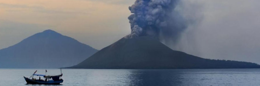
Evolution of the Island around Krakatau
In the aftermath of the eruption, it was found that the island of Krakatoa had almost entirely disappeared, except for the southern third. The Rakata cone was cut off along a vertical cliff, leaving behind a 250-metre (820 ft) deep caldera. Of the northern two thirds of the island, only a rocky islet named Bootsmansrots (Bosun's Rock'), a fragment of Danan, was left; Poolsche Hoed had totally disappeared.
As a result of the huge amount of material deposited by the volcano, the surrounding ocean floor was drastically altered. It is estimated that as much as 18–21 km3 (4.3–5.0 cu mi) of ignimbrite was deposited over an area of 1,100,000 km2 (420,000 sq mi), largely filling the 30–40 m (98–131 ft) deep basin around the mountain. The land masses of Verlaten and Lang islands were increased, as was the western part of the remnant of Rakata. Much of this gained material quickly eroded away, but volcanic ash continues to be a significant part of the geological composition of these islands.
Two nearby sandbanks (called Steers and Calmeyer after the two naval officers who investigated them) were built up into islands by ashfall, but the sea later washed them away. Seawater on hot volcanic deposits on Steers and Calmeyer had caused steam to rise, which some mistook for a continued eruption.
Global climate
In the year following the eruption, average Northern Hemisphere summer temperatures fell by as much as 1.2 °C (2.2 °F). Weather patterns continued to be chaotic for years, and temperatures did not return to normal until 1888. The record rainfall that hit Southern California during the “water year” from July 1883 to June 1884 –Los Angeles received 38.18 inches (969.8 mm) and San Diego 25.97 inches (659.6 mm) has been attributed to the Krakatoa eruption.There was no El Niño during that period as is normal when heavy rain occurs in Southern California,but many scientists doubt this proposed causal relationship.
The eruption injected an unusually large amount of Sulfur dioxde (SO2) gas high into the stratosphere , which was subsequently transported by high level winds all over the planet. This led to a global increase in sulfuric acid (H2SO4) concentration in high level cirrus clouds. The resulting increase in cloud reflectivity (or albedo) would reflect more incoming light from the sun than usual, and cool the entire planet until the suspended sulfurfell to the ground as acid precpitation .
Global optical effects
The eruption darkened the sky worldwide for years afterward, and produced spectacular sunsets throughout the world for many months. British artist William Ashcroft made thousands of colour sketches of the red sunsets half way around the world from Krakatoa in the years after the eruption. The ash caused "such vivid red sunsets that fire engines were called out in New York, Poughkeepsie, and New Haven to quench the apparent conflagration." This eruption also produced a Bishop's Ring around the sun by day, and a volcanic purple light at twilight.
In 2004, an astronomer proposed the idea that the blood red sky shown in Edward Munch's famous 1893 painting the Scream is also an accurate depiction of the sky over Norway after the eruption.
Weather watchers of the time tracked and mapped the effects on the sky. They labeled the phenomenon the "equatorial smoke stream". This was the first identification of what is known today as the jet stream
For several years following the eruption it was reported that the moon appeared to be blue and sometimes green Blue moons . resulted because some of the ash clouds were filled with particles about 1 wide—the right size to strongly scatter red light, while allowing other colors to pass. White moonbeams shining through the clouds emerged blue, and sometimes green. People also saw lavender suns and, for the first time, noctilucent clouds.
Possible causes
The fate of northern Krakatoa itself has been the subject of some dispute among geologists. It was originally proposed that the island had been blown apart by the force of the eruption. However, most of the material deposited by the volcano is clearly magmatic in origin and the caldera formed by the eruption is not extensively filled with deposits from the 1883 eruption. This indicates that the island subsided into an empty magma chamber at the end of the eruption sequence, rather than having been destroyed during the eruptions.
The established theories - based on the findings of contemporary investigators - assume that part of the island subsided before the first explosions on the morning of 27 August. This forced the volcano's vents below sea level causing:
- massive flooding which created a series of phreatic explosions (interaction of ground water and magma).
- seawater to cool the magma enough for it to crust over and produce a "pressure cooker" effect relieved only when explosive pressures were reached.
However there is geological evidence which does not support the assumption that only subsidence before the explosion was the cause. For instance, the pumice and ignimbrite deposits are not of a kind consistent with a magma-seawater interaction. These findings have led to other hypotheses:
- a massive underwater land slump or partial subsidence suddenly exposed the highly pressurized magma chamber to seawater.
- the final explosions may have been caused by magma mixing caused by a sudden infusion of hot basaltic magma into the cooler and lighter magma in the chamber below the volcano. This would have resulted in a rapid and unsustainable increase in pressure, leading to a cataclysmic explosion. Evidence for this theory is the existence of pumice consisting of light and dark material, the dark material being of much hotter origin. However, such material reportedly is less than 5% of the content of the Krakatoa ignimbrite and some investigators have rejected this as a prime cause of the 27 August explosions.
Verbeek investigation
Although the violent engulfment phase of the eruption was over by late afternoon of 27 August, after light returned by the 29th, reports continued for months that Krakatoa was still in eruption. One of the earliest duties of Verbeek's committee was to determine if this was true and also verify reports of other volcanoes erupting on Java and Sumatra. In general, these were found to be false, and Verbeek discounted any claims of Krakatoa still erupting after mid October as due to steaming of hot material, landslides due to heavy monsoon rains that season, and "hallucinations due to electrical activity" seen from a distance.
No signs of further activity were seen until 1913, when an eruption was reported. Investigation could find no evidence the volcano was awakening, and it was determined that what had been mistaken for renewed activity had actually been a major landslide (possibly the one which formed the second arc to Rakata's cliff).
Examinations after 1930 of bathymetric charts made in 1919 show evidence of a bulge indicative of magma near the surface at the site that became Anak Krakatau .